Mapping Our
Lead-Free Future
The largest source of lead in U.S. drinking water is the underground pipes connecting our homes to our local water systems.
Today, we don’t have a clear picture of how many lead pipes there may be across the country—and which communities are most at risk.
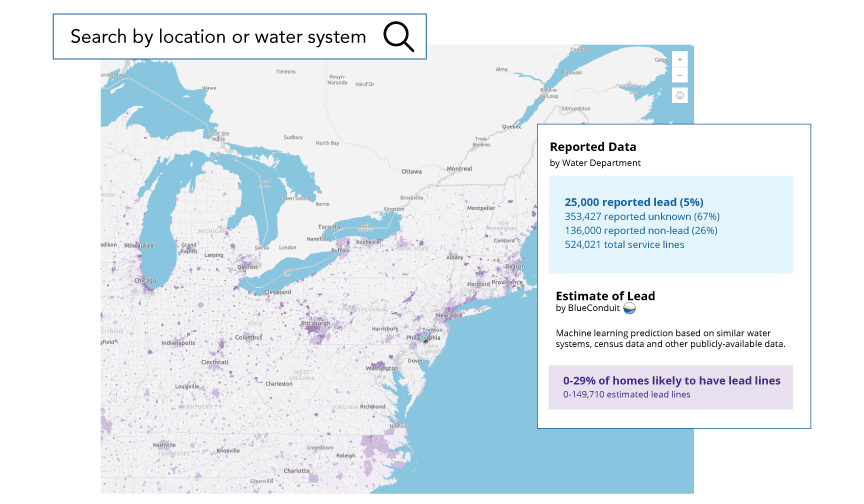
LeadOut Map’s predictive modeling and artificial intelligence help people understand their risk of lead exposure and take action. Our technology can help communities attract resources to locate and replace lead pipes more efficiently and equitably.

Why We Don’t Know the Location of Most Lead Pipes
The U.S. first set standards for lead in drinking water in the 1970s. However, many water systems did not keep consistent records of the materials used in pipes and other infrastructure. Some paper records have been lost or damaged; others exist in different places and formats.
The U.S. government has a plan to eliminate all lead service lines. This includes a new requirement that all water systems make lead pipe inventories publicly available.
LeadOut Map creates a clearer picture of risk, so we can protect our communities.

How LeadOut Map Works
LeadOut Map uses BlueConduit’s machine learning technology to create estimates based on wide-ranging national and local data, including water system reports, census and real estate data, historical records, and more. These estimates can help you take action to protect your household and advocate for safe and clean drinking water.

Data Science for the Public Good
LeadOut Map is a public, open-source, and interactive map powered by BlueConduit. It’s made possible with funding from The Rockefeller Foundation and Google.org. A team of Google employees—researchers, designers, product managers, and software engineers—worked with BlueConduit on a full-time, pro bono basis to help build the tool through the Google.org Fellowship program.


